Mount Roraima - (World Mysterious Places)


Location of Mount Roraima in eastern Venezuela (on border with Guyana and Brazil)
Highest point
Elevation 2,810 m (9,220 ft)
Prominence 2,338 m (7,671 ft)
Listing Country high point
Ultra prominent peak
Coordinates 5°08′36″N 60°45′45″WCoordinates: 5°08′36″N 60°45′45″W
Geography
Location Venezuela/Brazil/Guyana
Parent range Guiana Highlands
Geology
Mountain type Plateau
Climbing
First ascent 1884, led by Sir Everard im Thurn and accompanied by Harry Inniss Perkins and several Guyanese natives[2][3]:497
Easiest route Hike
Mount Roraima (Spanish: Monte Roraima [ˈmonte roˈɾaima], also known as Tepuy Roraima and Cerro Roraima; Portuguese: Monte Roraima [ˈmõtʃi ʁoˈɾajmɐ]) is the highest of the Pakaraima chain of tepui plateaus in South America.:156 First described by the English explorer Sir Walter Raleigh in 1596, its 31 km2 summit area:156 is bounded on all sides by cliffs rising 400 metres (1,300 ft). The mountain also serves as the triple border point of Venezuela (85% of its territory), Guyana (10%) and Brazil (5%).
Mount Roraima lies on the Guiana Shield in the southeastern corner of Venezuela's 30,000-square-kilometre (12,000 sq mi) Canaima National Park forming the highest peak of Guyana's Highland Range. The tabletop mountains of the park are considered some of the oldest geological formations on Earth, dating back to some two billion years ago in the Precambrian.
The highest point in Guyana and the highest point of the Brazilian state of Roraima lie on the plateau, but Venezuela and Brazil have higher mountains elsewhere. The triple border point is at 5°12′08″N 60°44′07″W, but the mountain's highest point is Maverick Rock, 2,810 metres (9,219 ft), at the south end of the plateau and wholly within Venezuela.
Flora and fauna
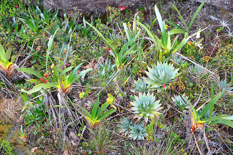 |
| Vegetation on Mount Roraima |
There are multiple examples of unique fauna atop Mount Roraima. Oreophrynella quelchii, commonly called the Roraima Bush Toad, is a diurnal toad usually found on open rock surfaces and shrubland. It is a species of toad in the family Bufonidae and breeds by direct development. The species is currently listed as vulnerable and there is a need for increased education among tourists to make them aware of the importance of not handling these animals in the wild. Close population monitoring is also required, particularly since this species is known only from a single location. The species is protected in Monumento Natural Los Tepuyes in Venezuela, and Parque Nacional Monte Roraima in Brazil.
Culture
Since long before the arrival of European explorers, the mountain has held a special significance for the indigenous people of the region, and it is central to many of their myths and legends. The Pemon and Kapon natives of the Gran Sabana see Mount Roraima as the stump of a mighty tree that once held all the fruits and tuberous vegetables in the world. Felled by Makunaima, their mythical trickster, the tree crashed to the ground, unleashing a terrible flood. Roroi in the Pemon language means blue-green and ma means great.
Ascents
 |
| The steep rock wall of Monte Roraima. |
Although the steep sides of the plateau make it difficult to access, it was the first recorded major tepui to be climbed: Sir Everard im Thurn walked up a forested ramp in December 1884 to scale the plateau. This is the same route hikers take today.
The only non-technical route to the top is the Paraitepui route from Venezuela; any other approach will involve climbing gear. Mount Roraima has been climbed on a few occasions from the Guyana and Brazil sides, but as the mountain is entirely bordered on both these sides by enormous sheer cliffs that include high overhanging (negative-inclination) stretches, these are extremely difficult and technical rock climbing routes. Such climbs would also require difficult authorizations for entering restricted-access national parks in the respective countries.
 |
| Maverick Rock, the highest point of Mount Roraima |
In Brazil the Monte Roraima National Park lies within the Raposa Serra do Sol Indigenous Territory, and is not open to the public without permission.
The 2013 Austrian documentary Jäger des Augenblicks - Ein Abenteuer am Mount Roraima (Moment Hunters - An Adventure on Mount Roraima) shows rock climbers Kurt Albert, Holger Heuber, and Stefan Glowacz climbing to the top of Mount Roraima from the Guyana side. Similarly, in 2010 Brazilian climbers Eliseu Frechou, Fernando Leal and Márcio Bruno opened a new route on the Guyanese side, climbing to the top in 12 days of a very difficult vertical wall climb. They called the new route Guerra de Luz e Trevas (Portuguese for "War of Light and Darkness") and classed it as 6° VIIa A3 J4. A 28-minute Vimeo video called Dias de Tempestade (Days of Storm) is available documenting their climb (English subtitles, audio in Portuguese).
Facts About Mount Roraima - strangefacts
- Mount Roraima (mountain, South America) giant flat-topped mountain, or mesa, in the Pakaraima Mountains of the Guiana Highlands , at the point where the boundaries of Brazil, Venezuela, and Guyana meet.
- About 9 miles (14 km) long and 9,094 feet (2,772 metres) high, it is the source of many rivers of Guyana, and of the Amazon and Orinoco.
- Mount Roraima is a pretty remarkable place. It is a tabletop mountain with sheer 400-metre high cliffs on all sides.
- There is only one ‘easy’ way up, on a natural staircase-like ramp on the Venezuelan side – to get up any other way takes and experienced rock climber
- On the top of the mountain it rains almost every day, washing away most of the nutrients for plants to grow and creating a unique landscape on the bare sandstone surface.
- This also creates some of the highest waterfalls in the world over the sides (Angel falls is located on a similar tabletop mountain some 130 miles away).
- Though there are only a few marshes on the mountain where vegetation can grow properly, these contain many species unique to the mountain, including a species of carnivorous pitcher plant.
- The mountain marks the border between Venezuela, Brazil and Guyana, although more than three quarters of the mountain is in Venezuelan territory .
- It is the highest mountain in Guyana, but Venezuela and Brazil have higher mountains. The triple border point on the summit is at 5°12'08N, 60°44'07W.
- Roraima lies on the Guiana Shield in the southeastern corner of Venezuela's 30,000 km² Canaima National Park, which is roughly located in the Gran Sabana region .
- The tabletop mountains of the park are considered some of the oldest geological formations on Earth, dating back to the Precambrian Era, some two billion years ago.
- The average height of the plateau is about 2,500 metres (8,200 feet), making it the highest point for distance of 549.44 kilometres (341.48 miles) in any direction.
- The nearest peak that is taller is Cerro Marahuaca, to the west-southwest.
- Despite the fact the steep sides of the plateau make it difficult to access, it was the first major tepui to be climbed: Sir Everard im Thurn walked up a forested ramp in December 1884 to scale the strangely wind-and-water sculpted plateau.
- This is the same route hikers take today.
- It is thought that the reports from early Victorian expeditions to the mountain inspired Sir Arthur Conan Doyle to write his classic adventure yarn, The Lost World, in 1912 - now made into countless films.
- Since long before the arrival of European explorers in Venezuela the mountain has held a special significance for the indigenous people of the region and it is central to many of their myths and legends.
- The Pemon Indians of the Gran Sabana see Roraima as the stump of a mighty tree that once held all the fruits and tuberous vegetables in the world.
- Felled by one of their ancestors, the tree crashed to the ground, unleashing a terrible flood. "Roroi" in the Pemon language means blue-green and "ma" means great.
- Mount Roraima has been climbed on a few occasions from the Guyana and Brazil sides, but as the mountain is entirely bordered on both these sides by enormous sheer cliffs that include high overhanging (negative-inclination) stretches, these are extremely difficult and technical rock climbing routes.


0 comments:
Post a Comment